|
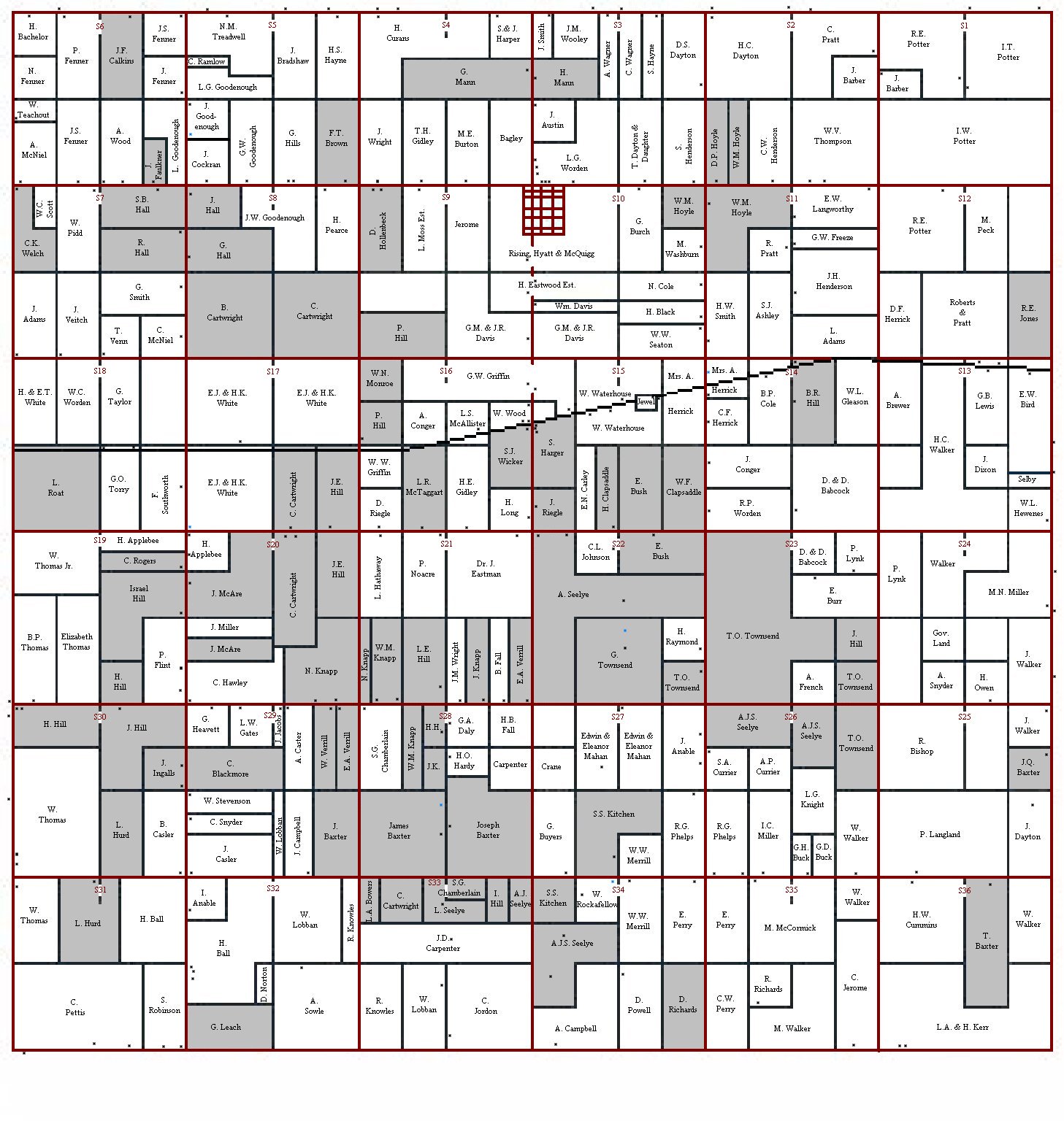
This is a map I created that is from the original 1873 Land Ownership map of Davison. The shaded areas are people related to me in some way, the dark square dots are the homes on the properties, and the blue square dots represent schools at the time.
|